New 60-year Swiss snow maps track stations well, except at low elevations
A quantile-mapped snow model gives 1 km daily Swiss snow data since 1962 that works well above 1000 m and for yearly or regional use, but is weaker at low elevations, single grid points and short time spans.
Why it matters
Long gridded snow records are rare, and station networks are unevenly spread over elevation. These datasets allow country-wide anomaly maps and elevation-dependent trend analysis. The authors advise spatial aggregation and caution at low elevations and single grid points.
What they did
The authors built daily 1 km snow water equivalent and snow depth datasets for Switzerland from 1962. They corrected a temperature index model by quantile mapping onto a shorter, higher-quality model that assimilates station data (OSHD-EKF). They compared the result with that model and with snow depth from 103 assimilated stations and 79 non-assimilated stations. They also compared trends from the gridded data and the stations, using Theil–Sen slopes and the Mann–Kendall test.
Key findings
- Against the higher-quality model, bias was close to zero for snow water equivalent. Relative error was about 37 % at 500 m and about 8 % at 2500 m for yearly values.
- Against stations, yearly snow depth RMSE was 25 cm (20 %) at 2500 m and 1.5 cm (80 %) at 500 m. The assimilating model was only slightly better.
- Bias at non-assimilated stations was hardly different from bias at assimilated ones. Above 2000 m, errors at non-assimilated stations were about 5 cm larger.
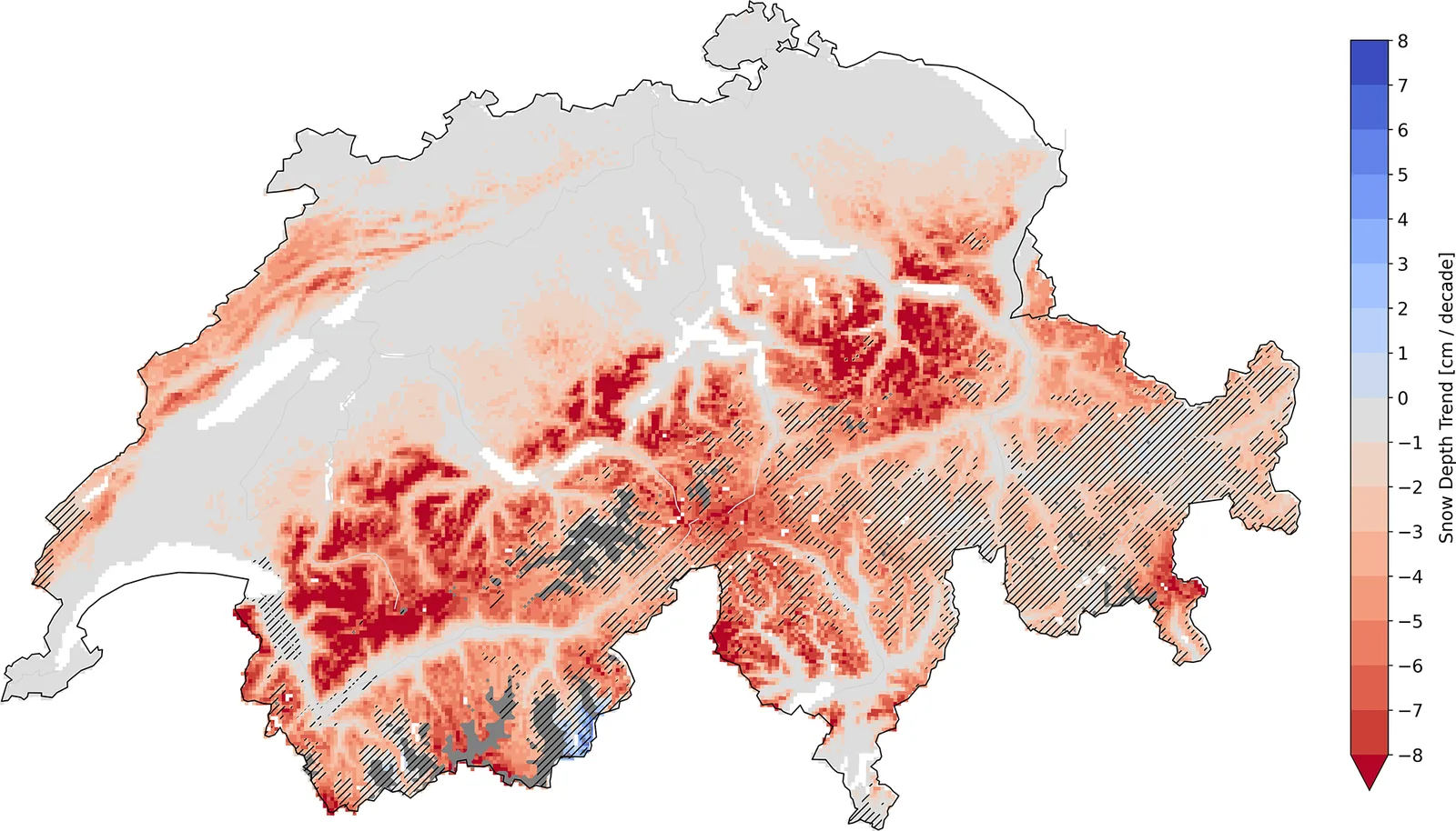
- Trends in yearly snow depth agreed with station trends in direction and significance in most elevation bands. At the lowest elevations, the models clearly overestimated the strength of the decline.
- For about 20 % of stations, grid-point and station trends differed by more than 1 cm/decade. Some even had opposite direction, owing to station inhomogeneities or input data problems.
Limitations
- Only one long-term station covers the 2500 m band, so trend agreement there carries little weight. Stations also tend to show more snow than the grid-cell average.
- The input temperature and precipitation grids are not perfectly consistent over time and miss small-scale effects. Snow depth is converted from snow water equivalent, which adds error.
- The quantile mapping works poorly where snow is scarce and does not capture extreme values well. Errors grow for weekly and monthly averages, and grid points above 3000 m were not analysed.
Glossary
- Snow water equivalent (SWE): The depth of water you would get if the snowpack melted.
- Quantile mapping: A correction that adjusts model values so their overall distribution matches a better target dataset.
- MAAPE: A relative error measure that limits the weight of large percentage errors when reference values are small.
- Theil–Sen slope: A robust way to estimate the strength of a trend in a time series.
Original paper
SPASS – new gridded climatological snow datasets for Switzerland: potential and limitations
The Cryosphere · 20 October 2025
AI-generated summary of the original article; changes were made. Check the original before relying on it.