New open dataset pairs pre-event optical and post-event radar images to map building damage
Bright is the first open, global dataset combining pre-disaster optical and post-disaster radar images of buildings, and models trained on it work well within known events but struggle on new ones.
Why it matters
Optical satellites cannot see through smoke, clouds or darkness, which slows damage mapping after disasters. Radar works in all weather, but AI models for it lacked shared training data. Bright gives researchers a common benchmark and shows where current methods fail, especially on unseen events.
What they did
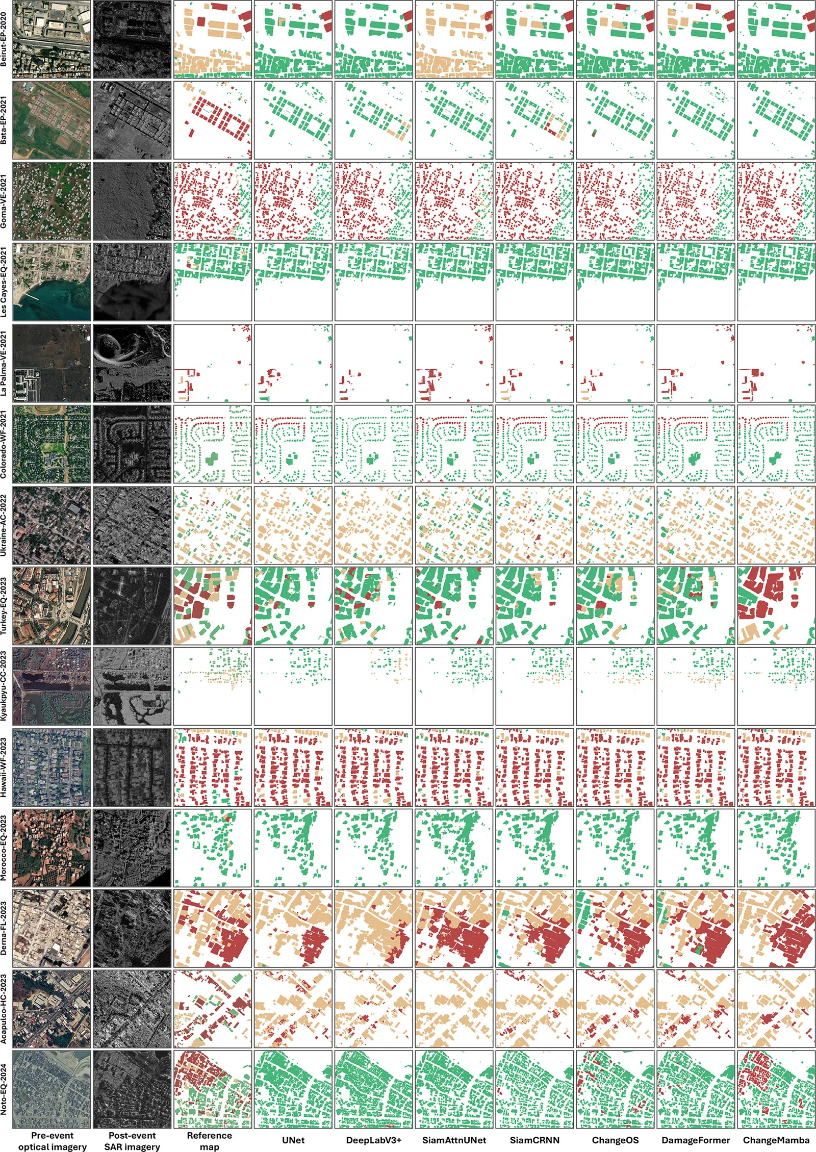
The authors collected pre-event optical and post-event radar (SAR) images from 14 disaster events, at 0.3 to 1 m resolution. Experts aligned the image pairs and labeled each building as intact, damaged or destroyed, using damage records from Copernicus, UNOSAT and FEMA. They cut the data into 4246 image pairs. They then trained seven deep learning models and tested them on standard splits and on cross-event setups with zero or one labeled sample from the new event. They also tested domain adaptation, semi-supervised learning, change detection and image matching methods.
Key findings
- ChangeMamba performed best on the standard split, with a mIoU of 67.63 % and an overall accuracy of 96.22 %. Models that split the task into locating buildings and then classifying damage beat those that predicted damage directly.
- On new, unseen events, average mIoU for all baseline models fell below 40 % in the zero-shot setting. One labeled sample from the new event improved every model.
- Wildfire and volcano events gave the best results for destroyed buildings, with IoU above 70 %. Earthquakes were hardest for all models, and the damaged class was hard to detect in most event types.
- Where good post-event optical images existed, optical-only gave higher mIoU than radar-only (69.76 % vs 65.56 % for DamageFormer). Combining both gave the best result (70.79 %).
- Unsupervised change detection methods scored F1 of 70 %–85 % on older benchmarks but about 20 % on Bright. Feature-based image matching methods failed to register the images automatically.
Limitations
- Small alignment errors between optical and radar images and some label noise from visual damage interpretation remain.
- Events are unevenly sized (Turkey earthquake 1114 tiles vs Hawaii wildfire 65 tiles), and none are in the southern hemisphere.
- The dataset has only single-polarization radar, no time series, and covers events from 2020 onward.
Glossary
- SAR (synthetic aperture radar): A satellite sensor that sends out microwaves and records the echo, so it can image through clouds, smoke and darkness.
- mIoU: Mean intersection over union, a score of how well predicted areas overlap the true labeled areas, averaged over classes.
- Zero-shot / one-shot transfer: Testing on a new disaster with no labeled samples from it (zero-shot) or with a single labeled image pair (one-shot).
- Unsupervised domain adaptation: Methods that adapt a model to a new setting without using labels from that setting.
Original paper
Bright: a globally distributed multimodal building damage assessment dataset with very-high-resolution for all-weather disaster response
Earth System Science Data · 18 November 2025
AI-generated summary of the original article; changes were made. Check the original before relying on it.