Review: deep learning helps spot potential landslides but needs fused data and physics
Deep learning is widely used to find slopes at risk of failing, but data scarcity, weak interpretability and complex landslide physics limit it, so the authors urge fusing many data sources and combining models with physical knowledge.
Why it matters
Finding unstable slopes before they fail supports prevention instead of post-disaster response. The review shows which data and model types suit which tasks, so practitioners can choose tools more sensibly. It also lists the gaps, such as missing benchmarks and unclear model reasoning, that block wider use in engineering practice.
What they did
The authors reviewed more than 400 studies, mostly from 2020 to 2025, plus key earlier works. They sorted the data into satellite, airborne and ground-based sources. They grouped deep learning models by role: image analysis, time series, data generation, anomaly detection and data fusion. They then looked at uses for rainfall, earthquake, human-activity and multi-factor landslides.
Key findings
- No single data source is enough. Satellite InSAR suits wide screening, UAV and LiDAR add detail, and ground sensors give real-time monitoring.
- CNN-based models, including U-Net, are the core tools for image-based landslide mapping. LSTM, GRU and Transformer models are used for displacement time series.
- Generative models (GANs, VAEs, diffusion models) can ease the shortage of labeled landslide samples. Diffusion models are still exploratory for landslide identification.
- Graph neural networks and Transformers can fuse images, time series and other data types. Model ensembles can improve generalization, at higher computational cost.
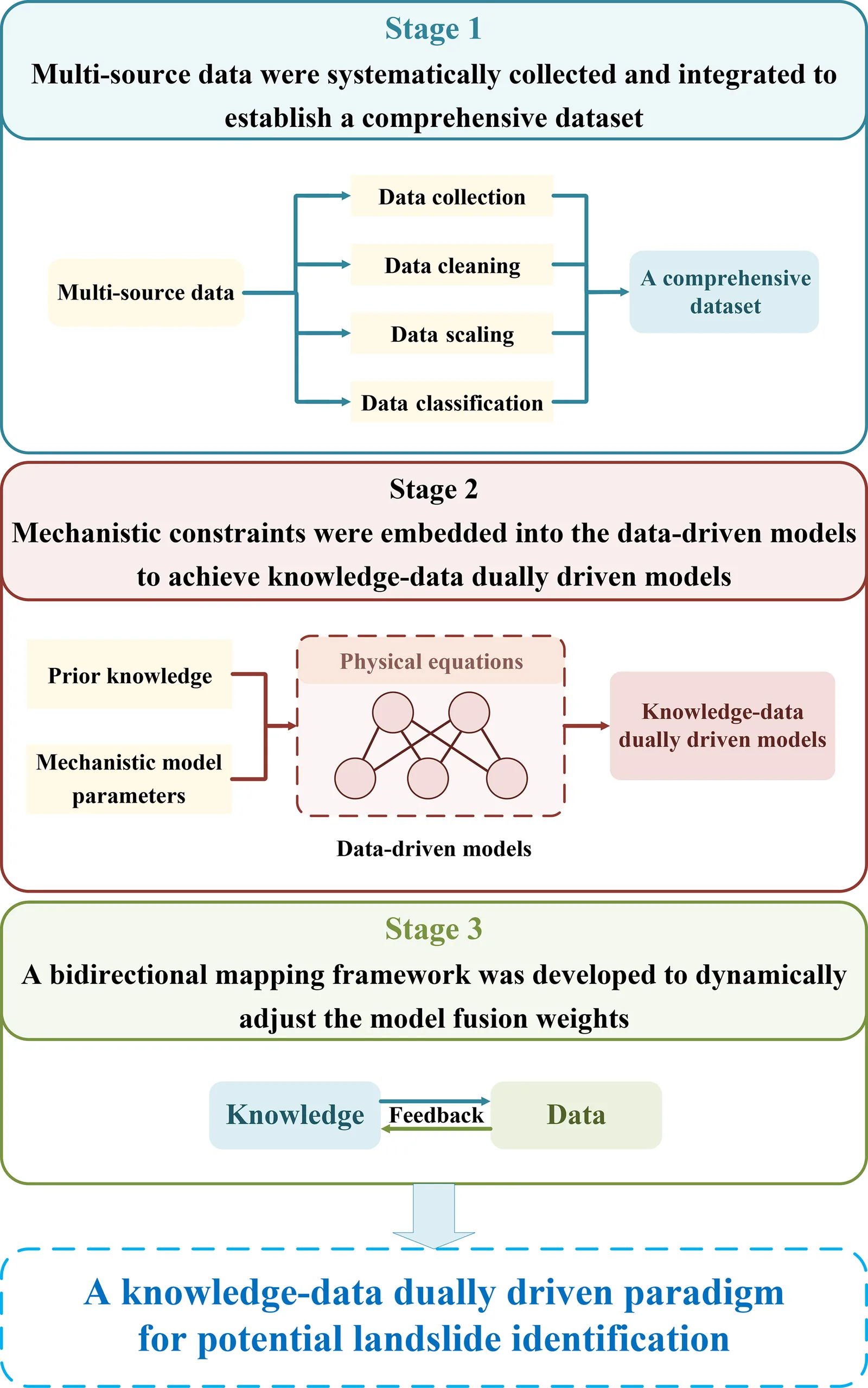
- The authors propose a knowledge-data dually driven approach, such as physics-informed neural networks, to improve interpretability and transfer across regions.
Limitations
- Landslide data are scarce, imbalanced and often biased, and benchmarks are not standardized, so models are hard to compare fairly.
- Deep learning models are hard to interpret and tend to learn statistical patterns rather than physical mechanisms, so transfer across regions often needs manual annotation.
- Hidden subsurface structures and the wide variety of landslide types make mechanisms hard to model, and applications of physics-informed networks in landslide research remain limited.
Glossary
- InSAR: A radar method that compares phase differences between satellite images of the same place to measure ground deformation.
- LSTM: A type of recurrent neural network with memory cells that keeps useful information over long time series.
- Physics-informed neural network (PINN): A neural network trained with governing physical equations built into its training objective.
- Data imbalance: A large gap between the number of non-landslide samples and landslide samples, which biases models toward the majority class.
Original paper
Review article: Deep learning for potential landslide identification: data, models, applications, challenges, and opportunities
Natural Hazards and Earth System Sciences · 26 January 2026
AI-generated summary of the original article; changes were made. Check the original before relying on it.